---
layout: work.njk
title_zh: Re:Earth Visualizer
title_ja: Re:Earth Visualizer
title_en: Re:Earth Visualizer
year: 2020
cover: /images/2020-re-earth-visualizer/cover.jpg
materials: 开源 3D GIS 平台 · React + Cesium + Go
materials_ja: オープンソース 3D GIS プラットフォーム · React + Cesium + Go
materials_en: Open-source 3D GIS platform · React + Cesium + Go
description: "Open-source 3D GIS platform built from zero since 2020 with a small team at Eukarya. Officially adopted by Japan's MLIT PLATEAU initiative; runs daily across ~20 municipalities. visualizer.reearth.io · reearth/reearth-visualizer."
workTags:
  - software
  - commercial
pinned: true
---

<div class="gallery">
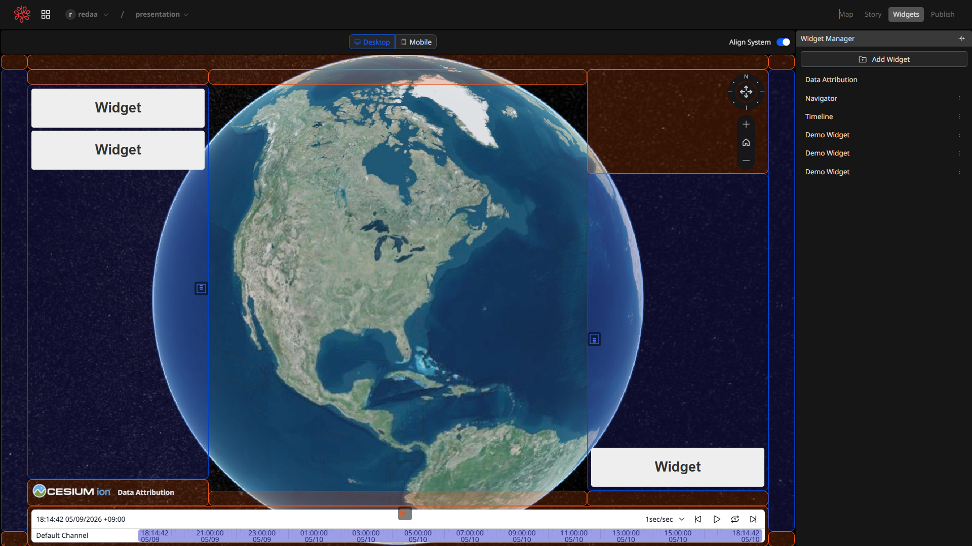
  <img loading="lazy" src="/images/2020-re-earth-visualizer/production-ui.png" alt="Re:Earth Visualizer — 生产环境 UI(widget 模式)">
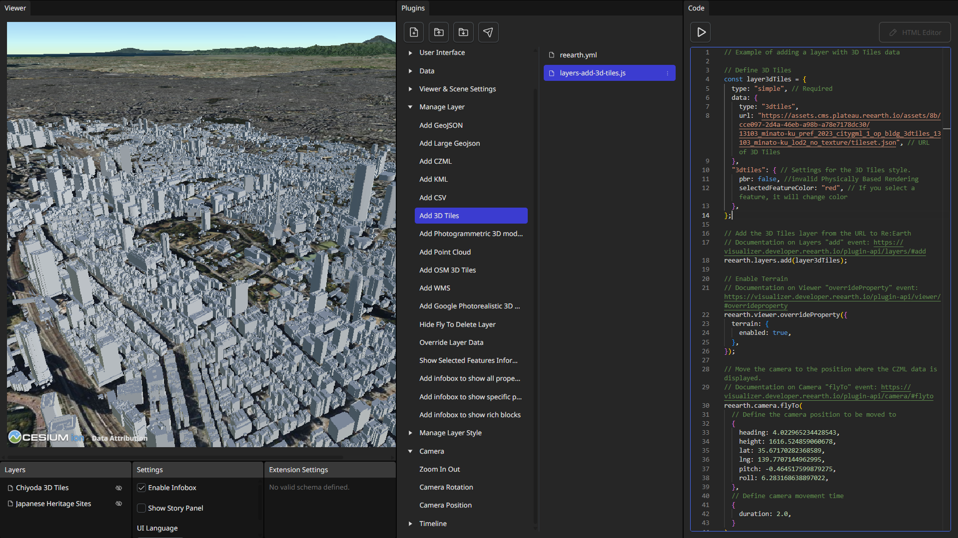
  <img loading="lazy" src="/images/2020-re-earth-visualizer/plugin-playground.png" alt="Re:Earth Visualizer — Plugin playground">
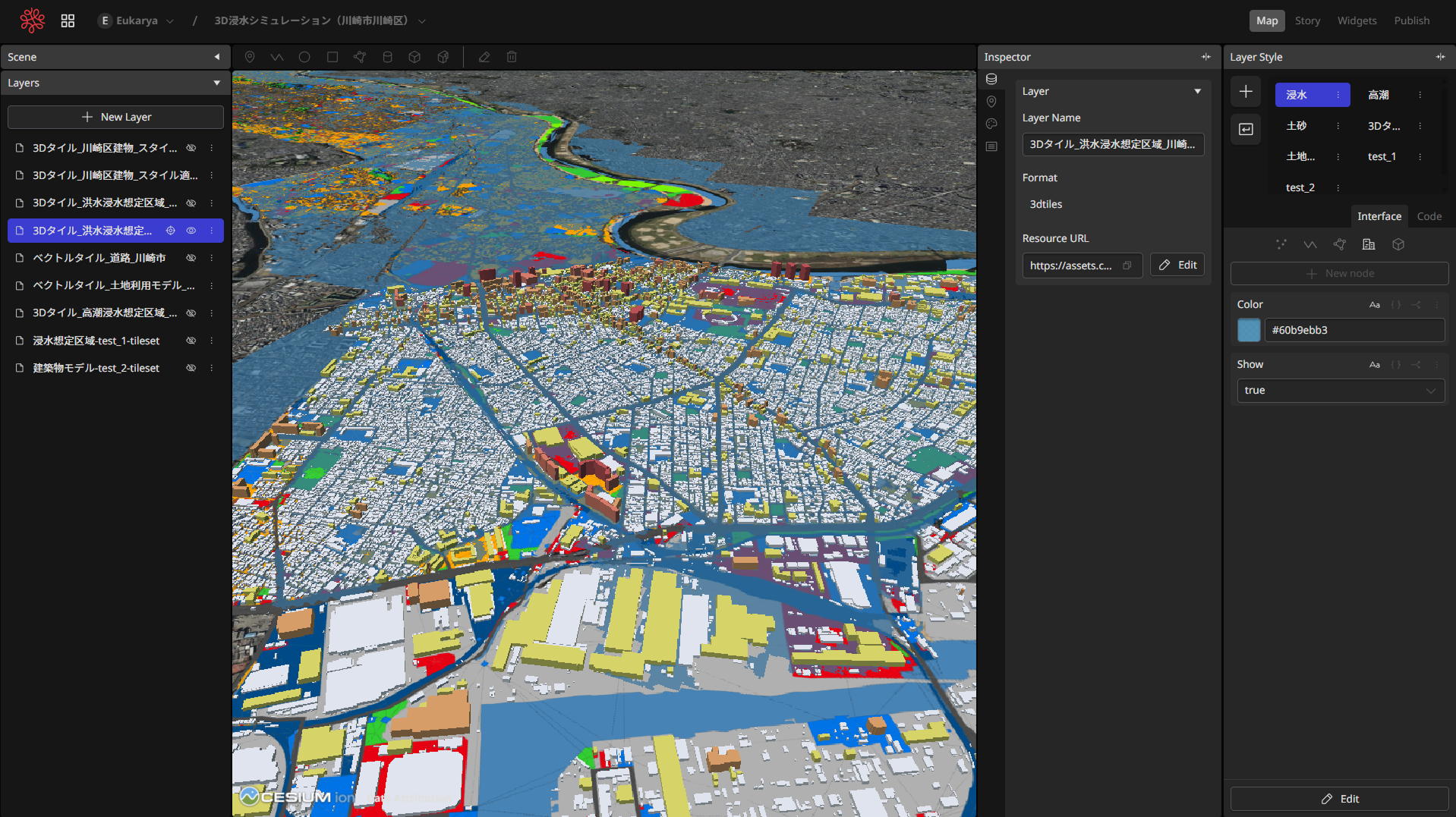
  <img loading="lazy" src="/images/2020-re-earth-visualizer/layer-model.png" alt="Re:Earth Visualizer — 图层模型 UI">
</div>

<div lang="zh">

2020年,开始做 Re:Earth Visualizer ——一个开源的 3D GIS 平台。和一支小团队,从零开始。

我作为 founding designer / Product Owner,负责产品方向、信息架构、范围、招人,以及内部的设计系统。和一支懂 TypeScript / Cesium / 3D Tiles 的工程团队每天一起做。

五年过去了。它成了日本国土交通省 PLATEAU 计划的官方查看器——这个国家「数字孪生」的标准底层——在大约 20 个自治体的日常工作中运行。从 0 到「标准」。

界面上看得见的是地图、图层、插件、widget;但真正在判断的,往往是它们底下那一层抽象——「图层是什么」「插件是什么」「空间是什么」。很多时候,问题不是「这个界面要怎么做」,而是「我们用什么抽象去想这件事」。

更具体的设计决策——重构图层模型、插件 playground、widget 的排版语言——写在了另一个作品集里:[product-portfolio.surreal.red](https://product-portfolio.surreal.red)。

产品:[visualizer.reearth.io](https://visualizer.reearth.io) · 代码:[reearth/reearth-visualizer](https://github.com/reearth/reearth-visualizer)

</div>

<div lang="ja">

2020年。小さなチームで、Re:Earth Visualizer をつくりはじめた——オープンソースの 3D GIS プラットフォーム。何もないところから。

立ち上げ期のデザイナー兼 Product Owner として、プロダクトの方向、IA、スコープ、採用、社内デザインシステムを担当してきた。TypeScript / Cesium / 3D Tiles を扱うエンジニアチームと、毎日一緒につくっている。

5年が経って、いまは国土交通省 PLATEAU プロジェクトの標準ビューワーになっている。日本の「デジタルツイン」の土台で、およそ 20 の自治体で日常的に動いている。ゼロから「標準」へ。

画面に見えているのは地図やレイヤー、プラグイン、ウィジェット——けれど実際に判断していたのは、そのひとつ下の抽象だった。「レイヤーとは何か」「プラグインとは何か」「空間とは何か」。UI の話というより、何を抽象に選ぶかの話だ。

もう少し具体的な設計判断——レイヤーモデルの再構築、プラグインの playground、ウィジェットのレイアウト言語など——は、もう一つのポートフォリオに書いている:[product-portfolio.surreal.red](https://product-portfolio.surreal.red)。

プロダクト:[visualizer.reearth.io](https://visualizer.reearth.io) · ソース:[reearth/reearth-visualizer](https://github.com/reearth/reearth-visualizer)

</div>

<div lang="en">

2020 — I started Re:Earth Visualizer with a small team. An open-source 3D GIS platform. From zero.

As founding designer and Product Owner, I owned product direction, IA, scope, hiring, and the in-house design system — building it every day alongside an engineering team working in TypeScript / Cesium / 3D Tiles.

Five years in, it's now the standard viewer behind Japan's MLIT PLATEAU initiative — the foundation of the country's digital twin — running daily in roughly twenty municipal governments. From zero to standard.

What you see on screen is maps, layers, plugins, widgets — UI. What we were actually deciding usually lived one layer below: data models, plugin sandboxes, layout languages. Most decisions weren't "what should the interface look like" but "what abstraction are we choosing to think with."

The specific design decisions — rebuilding the layer model, the plugin playground, a layout language for widgets — are written up on my other portfolio: [product-portfolio.surreal.red](https://product-portfolio.surreal.red).

Product: [visualizer.reearth.io](https://visualizer.reearth.io) · Source: [reearth/reearth-visualizer](https://github.com/reearth/reearth-visualizer)

</div>