A No-Code 3D WebGIS in the Browser
GIS has historically been tied to specific hardware, specific operating systems, and a specific kind of user. The framing question behind this project was simpler: what would be possible if anyone, anywhere — without special hardware, without writing code — could work with the digital earth?
Three design bets followed from that question:
- A fully browser-based application — no install, no platform-specific build, available from any device with a browser
- No-code authoring as the default mode — managing, editing, computing, and publishing 3D geospatial data without writing anything
- A plugin system that runs in the browser at runtime — extending the map itself, rather than just configuration files around it
We also made the open-source bet early. The wrapper that lets Cesium be used cleanly from React — Resium — was released as a stand-alone OSS package before the main product was finished, and it's still maintained and used outside our team.
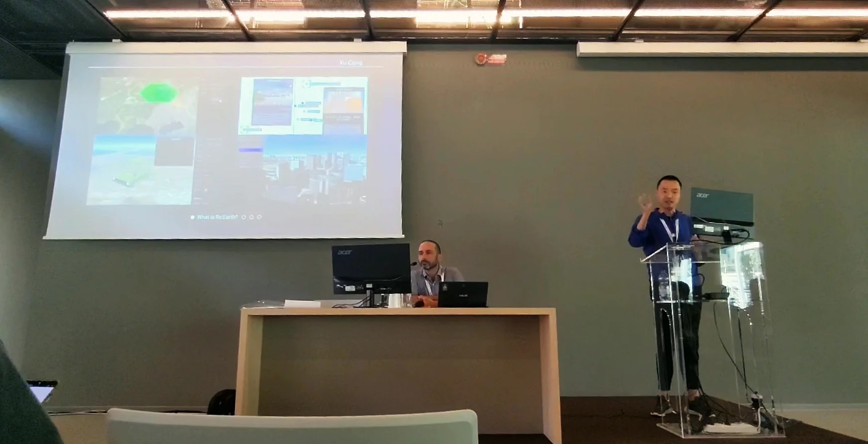
This was a 4-minute lightning talk — the project's first public introduction at FOSS4G. The product, Re:Earth — the open-source WebGIS our team builds — was at version 1.x at the time, on a React / TypeScript front end and a Go back end, picked so the codebase would stay readable enough for outside contributors to engage with. A few years on, the bets have mostly held, and the project has expanded into the general-purpose data-management surface the talk hinted at.
The underlying mission — open the digital earth, let people who aren't professional GIS users do real work on it — is still the right thing to keep solving.
---
layout: talk.njk
title_zh: "能在浏览器里跑的 no-code 3D WebGIS"
title_ja: "ブラウザで動く、ノーコードの 3D WebGIS"
title_en: "A No-Code 3D WebGIS in the Browser"
year: 2022
event: FOSS4G 2022
eventUrl: https://2022.foss4g.org/
role: speaker
location: 意大利,佛罗伦萨
location_ja: イタリア・フィレンツェ
location_en: Florence (Firenze), Italy
cover: /images/talks/foss4g-2022-no-code-3d-webgis/hero.jpg
description: "A 4-minute lightning talk introducing a new open-source, fully browser-based, no-code 3D WebGIS — and the design bets underneath it: no install, no platform-specific build, plugins that load at runtime, and a stack chosen so the codebase is something outside contributors can actually engage with."
videos:
  - url: https://www.youtube.com/watch?v=qirqWIhblMA
    title: 官方录像
    title_ja: 公式録画
    title_en: Official conference recording
workTags:
  - talk
---

<div lang="zh">

GIS 在历史上一直被绑在特定的硬件、特定的操作系统,以及特定的用户身上。这个项目背后真正要问的问题其实更简单:如果任何人,在任何地方,不需要特殊硬件、不需要写代码,都能在地球这层数据上面工作,会是什么样子?

从这个问题出发,落下三个具体的设计赌注:

- 完全跑在浏览器里的应用——免安装、不依赖平台特定的构建,只要有浏览器就能打开
- 默认就是 no-code 的编辑模式——3D 地理空间数据可以直接管理、编辑、计算、发布,不必写一行代码
- 一套运行时跑在浏览器里的插件系统——它扩展的是地图本身,而不只是配置文件

我们在比较早的阶段就压了 OSS 这一注。让 Cesium 能在 React 里干净地用起来的那一层 wrapper——Resium——在主产品还没完成的时候,就作为独立的开源包先发出去了。直到现在还在被维护,也在我们团队之外被人用着。

这次是一场 4 分钟的闪电演讲,也是这个项目在 FOSS4G 上第一次公开亮相。当时 Re:Earth——我们团队在公开开发的开源 WebGIS——还在 1.x 阶段,前端用 React / TypeScript,后端用 Go,这么选是为了让代码保持在一种「外部贡献者也愿意去读」的状态。几年过去了,当时的几个赌注基本都还活着,整个项目也朝着当时演讲里提到的那个「通用数据管理层」的方向继续长。

底下那条线——把数字地球打开,让那些并不是专业 GIS 用户的人,也能在它之上做真的工作——到今天依然是值得继续解的事。

</div>

<div lang="ja">

GIS は歴史的に、特定のハードウェアと、特定の OS と、特定のタイプのユーザーに縛られてきた。このプロジェクトの背後にあった問いはもっと単純だった──特別なハードウェアもなく、コードも書かずに、誰でも、どこからでも、デジタル地球を扱えるとしたら、何が可能になるか。

その問いから導かれた、3 つの設計上の賭け。

- 完全にブラウザベースのアプリケーション──インストール不要、プラットフォーム固有のビルド不要、ブラウザがあるデバイスならどこからでも開ける
- ノーコードでの編集をデフォルトに──3D 地理空間データを、何も書かずに管理・編集・計算・公開する
- ブラウザの中でランタイムに動くプラグインシステム──設定ファイルを書き換えるのではなく、マップそのものを拡張する

オープンソースの賭けも早い段階で打った。Cesium を React から綺麗に使うためのラッパー──Resium──は、本体製品が完成するより前に、独立した OSS パッケージとして公開してある。今もメンテナンスが続いていて、私たちのチームの外でも使われている。

これは 4 分のライトニングトークで、FOSS4G の場でこのプロジェクトを初めて公に紹介した登壇だった。当時、Re:Earth──私たちのチームが開発しているオープンソースの WebGIS──はバージョン 1.x の段階で、フロントは React / TypeScript、バックは Go という構成で組まれていた。外部の貢献者にも読みやすいコードベースを保てるように、という選択である。数年経ったいま、当時の賭けは概ね生き残っていて、プロジェクト自体は、当時のライトニングトークがほのめかしていた「汎用的なデータマネジメントの土台」へと広がってきている。

根っこにあるミッション──デジタル地球を開き、プロの GIS ユーザーでない人にも、その上で本当の仕事をしてもらう──は、いまも解くに値することだと思っている。

</div>

<div lang="en">

GIS has historically been tied to specific hardware, specific operating systems, and a specific kind of user. The framing question behind this project was simpler: what would be possible if anyone, anywhere — without special hardware, without writing code — could work with the digital earth?

Three design bets followed from that question:

- A fully browser-based application — no install, no platform-specific build, available from any device with a browser
- No-code authoring as the default mode — managing, editing, computing, and publishing 3D geospatial data without writing anything
- A plugin system that runs in the browser at runtime — extending the map itself, rather than just configuration files around it

We also made the open-source bet early. The wrapper that lets Cesium be used cleanly from React — Resium — was released as a stand-alone OSS package before the main product was finished, and it's still maintained and used outside our team.

This was a 4-minute lightning talk — the project's first public introduction at FOSS4G. The product, Re:Earth — the open-source WebGIS our team builds — was at version 1.x at the time, on a React / TypeScript front end and a Go back end, picked so the codebase would stay readable enough for outside contributors to engage with. A few years on, the bets have mostly held, and the project has expanded into the general-purpose data-management surface the talk hinted at.

The underlying mission — open the digital earth, let people who aren't professional GIS users do real work on it — is still the right thing to keep solving.

</div>

<div class="gallery">
  <img src="/images/talks/foss4g-2022-no-code-3d-webgis/hero.jpg" alt="FOSS4G 2022 佛罗伦萨大会现场演讲">
</div>